Infra-red Linescan Aircraft
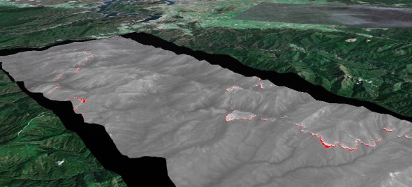
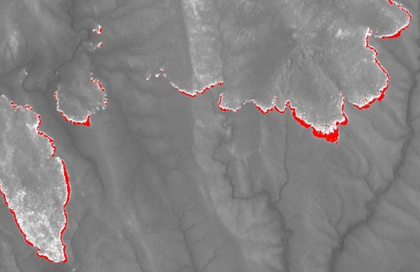
The SAU also manages a twin engined fixed wing aircraft (known as “Firescan 350”) that is fitted with an infra-red line scanner. Mounted in a Cessna 404 aircraft, the scanner is able to detect and record fire activity by sensing infra-red radiation generated by the fire. The scanner also records background information such as terrain, streams and roads, allowing pinpointing of fire edges, burnt areas and spotfires. As the scanner is able to "see" through smoke, it has particular application where smoke or haze prevents mapping or intelligence gathering by other means.

Primary fire fighting applications for the scanner include:

  • obtaining intelligence at remote or inaccessible fires, at fires where smoke or haze is a problem,
       or where it is useful to obtain information at night
  • obtaining intelligence on, and mapping, very fast moving fires - this can be done in an "tactical" mode
       where the intelligence is immediately able to be used in directing attack
  • monitoring the effectiveness of fire control strategies such as backburning detection of "spot overs"
       during control activities

    During operations the aircraft, which is fitted with satellite navigation equipment, will generally fly at a height of4,000 metres above ground level, travel at around 340 km/h and detectfires in a 4 kilometres wide strip. The aircraft is capable of detecting fires with a diameter as small as 20cm and pick up temperature differences of as little as 0.2oC. Information gathered is normally conveyed to ground units by:

  • radio transmission of the "Firescan" digital data files
  • landing at a nearby aerodrome and handing the images to fire control staff
  • dropping prints or computer disks at a pre-arranged location

    Linescan is a joint project between the SAU and the DSE Fire Information and Systems Group.